Flashline-16 Science Report-01 30-06-2024
Author: Natasha Nicholson – Chief Science Officer
Expedition Area:
Resolute Bay area, southwest of Char Lake, approximately 1km west-northwest of the hamlet of Resolute, Cornwallis Island, Nunavut, Canada. Expedition duration: 0945 to 1130 CST, Sunday 30 June 2024.
Water Sampling:
The first triplicate samples were taken at 0950 from a small body of water southeast of Char Lake, from the following coordinates: 74°42’5”N 94°52’5”W.
The next triplicate samples were taken at 1030 from a small stream running between the body of water and the hill line running east of Char Lake, at coordinates: 74°42’11.8”N 94°51’54.5”W. The lake was running down the hill from the scrapyard northwest of Resolute hamlet and contained yellow-green algal mats below the surface of the water, attached to the bottom of the riverbed, which we photo-documented.
The third sampling site was a snowbank partway up the hills to the east of the lake, from coordinates 74°42’16”N 94°51’36”W, taken at 1050. It was noted that the snow crystals were large, approximately 0.3-0.5cm across, resembling the dull edged shards of broken tempered glass. All samples were captured in 80mL Pyrex glass jars.
Permafrost Measurements:
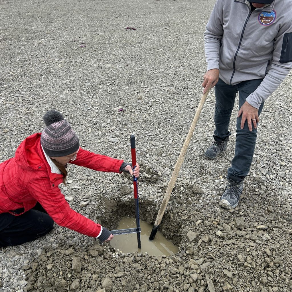
A site was selected at coordinates: 74°42’13”N 94°51’45”W.
A single hole was dug into the clay rich soil peppered with small to medium rocks. The hole was dug using a pointed tip shovel. To minimize disruption to the site, layers of soil were piled according to the depth they were extracted from, so the excavated material could be returned in order, depth for depth.
The digging continued until the spade met with strong resistance, which was deemed to be the start of the permafrost. However, fully opaque muddy water had filled the hole, making it hard to judge for certain. After removing a large rock and digging further, a uniform solidity was discovered, and after scraping determined the hard area had no edges and took up the entirety of the hole. As no rocks approaching that size were found in the area, it was determined that this was likely to be the permafrost. By the time of digging completion, the hole was approximately 70cm x 120cm, and the depth measurements ranged from 52 cm to 55 cm.
When the measurements had been taken, the excavated material was put back into the hole in reverse order to how it had been removed, keeping the original depths of the material as consistent as possible.
Radiation Measurements:
Radiation was measured using the Radiacode portable dosimeter, which tracked radiation levels at 2 minute intervals for the duration of the sampling expedition. Dosimeter readings showed a rise in radiation as we traversed the landscape.
Field Observations:
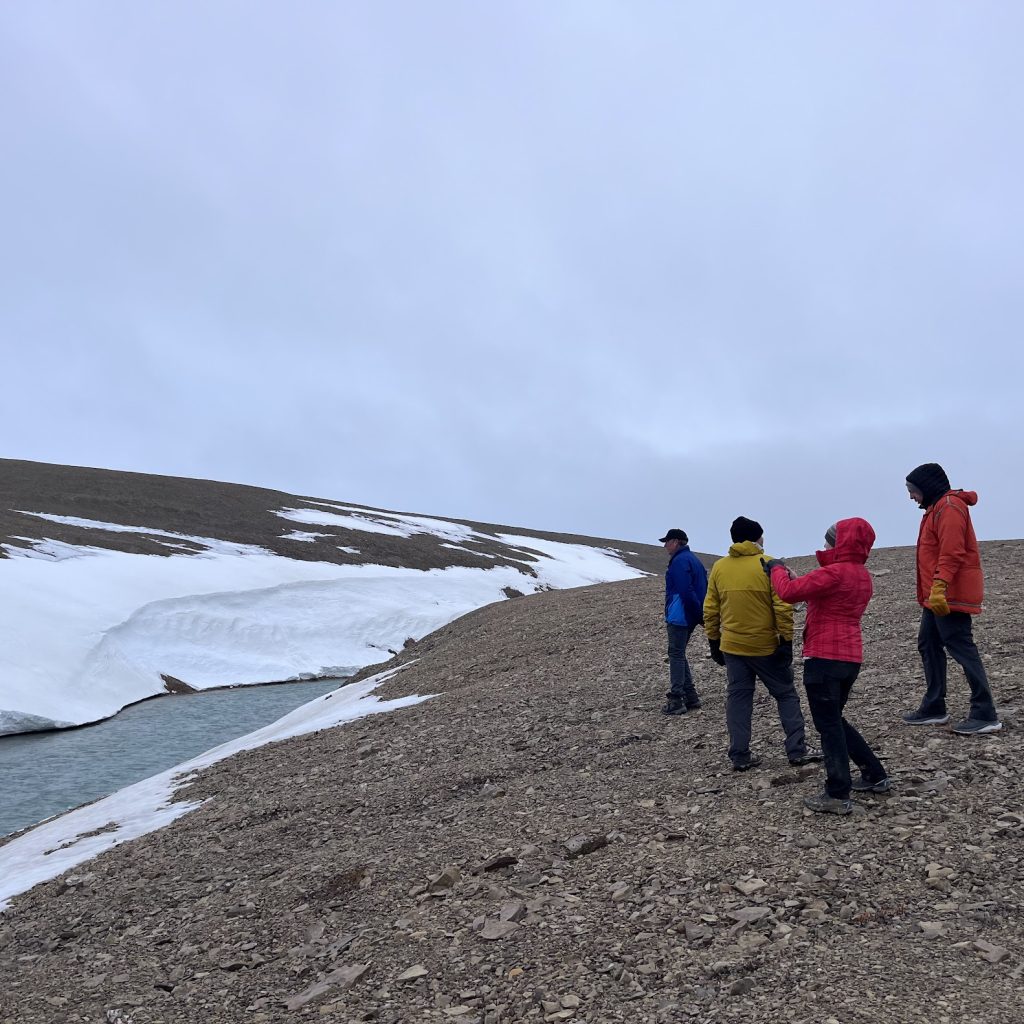
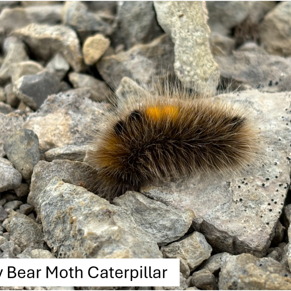
The sampling areas were relatively close together, no more than a few hundred metres, and yet the expedition took 1h 45mins. The reason for the long duration of the trip were the number of flora specimens observed along the way, and one incredibly fortunate fauna sighting: the woolly bear moth caterpillar, Gynaephora groenlandica, one of the rare multicellular extremophiles, capable of full cryptobiosis.
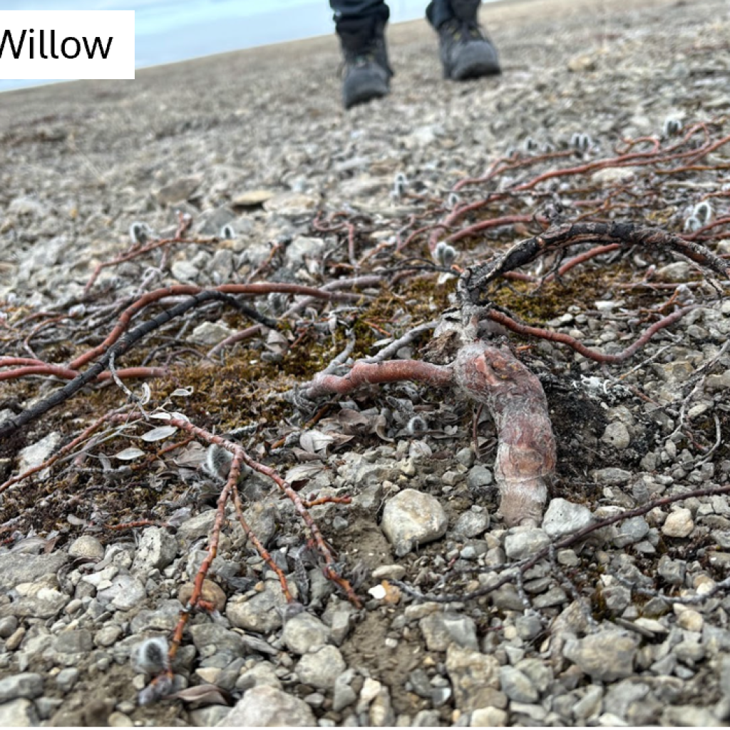
We also discovered a forest of trees no more than a few centimetres off the ground, which resembled root systems without trunks, and leafing/flowering bodies flat to the ground. These were most likely Arctic Willow, or Salix arctica, which were beginning to leaf and producing their seeds.
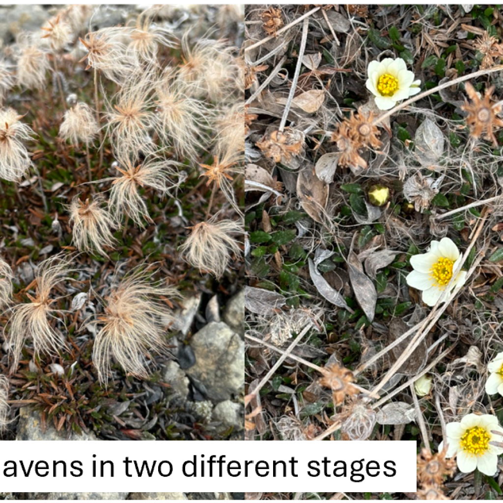
Other lichens, bryophytes and small flowering plants were also photo-documented, such as Arctic avens and/or Eightpetal mountain-avens (Dryas integrifolia and Dryas octopetala), and may be of interest for future expeditions, especially for ecologists and botanists.