Flashline-16 EVA Report 04-07-2024
Leader: Natasha Nicholson
Team: Ilaria Cinelli, Tiffany Swarmer, Terry Trevino
Destination(s): The alluvial plain northeast of Trinity Lakes.
Transport: On foot
Duration: 3.15hrs
Time: 15:30 – 18:45
Furthest coordinates from the station: 75°26’30”N, 89°45’30.4”W
Expedition Description:
The expedition consisted of two science officers (Natasha and Terry), and two team members on bear watch (Ilaria and Tiffany).
We set out at 15:30, heading northeast towards Trinity Lake, crossing rough chunks of rock as we transected the slope. Neither scientist is a qualified geologist, although both have some experience with geology or working with geologists, so the observations made are all speculative. We believe we found some of the grey breccia mentioned in Osinski et al.’s ‘Geological overview and cratering model for the Haughton impact structure, Devon Island, Canadian High Arctic’ (2005), and a potential stromatolite, which we geotagged and left in-situ.
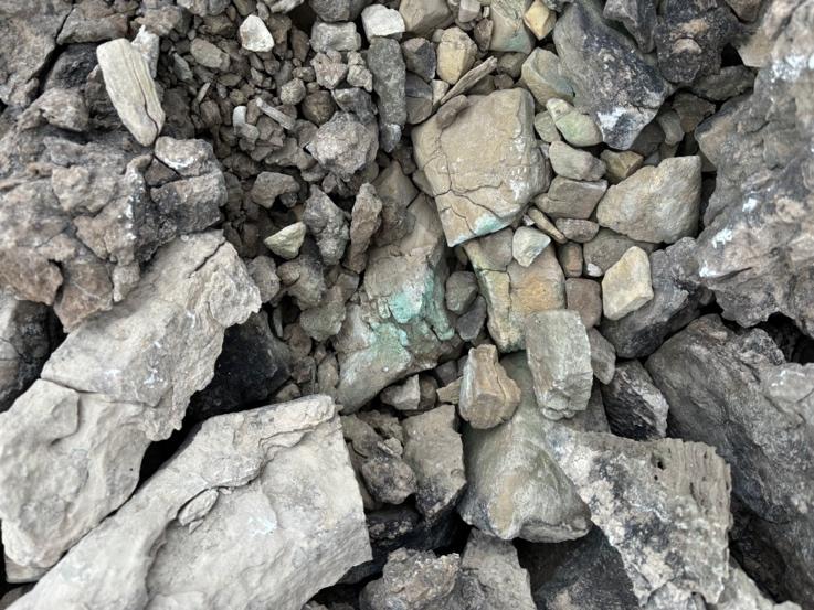
Figure 1. Potential Stromatolite.
Descending towards the gully entrance, leading northeast to the lakes, we found the ground very soft and easy to disturb, one’s feet sinking easily. The sinking is not the same as marshy or muddy environments; the foot leaves the soil again quickly, without suction force, but the ground is fragile and once deformed does not refill quickly. Wary of leaving tracks that could potentially last decades or more, and mindful of keeping line of sight open for bear watching, the party divided, with watchers moving up the ridges lining the gulley, and the scientists following the small stream. It is possible to identify the softer patches of ground to avoid, as their surfaces appear free of rocks, but sometimes even areas with rocks will sink underfoot.
We quickly learned to adapt our walking style, jumping from rock to rock, or following seams of rocks that clustered in wavy lines through the valley floor. We discovered these rocks were more concentrated by the water channel and made the rest of our way to the lake across these rocks. From the bear-watchers’ debrief, it seemed the way up the slope to the ridge top was difficult, but that the ground was firm underfoot when they reached the top.

Figure 2. Water channel.
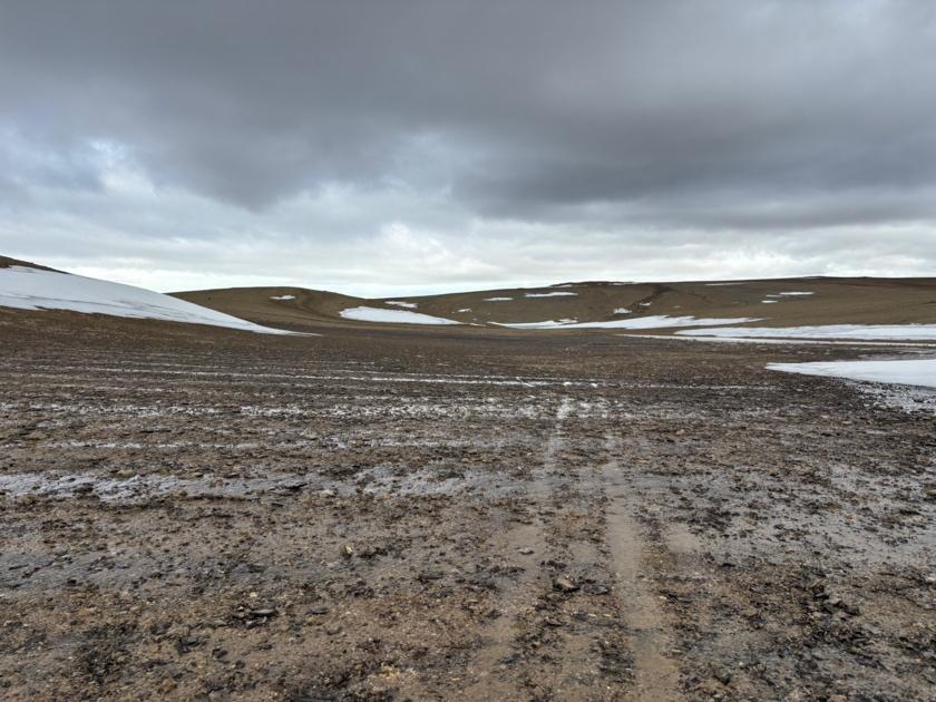
Figure 3. Wet conditions. Care is taken to disturb as little as possible.
Sampling at Trinity Lake was uncomplicated; the lake itself was half frozen on the north side, leaving the south side accessible, and some convenient rocks jutting from the water allowed for easy sampling without disturbing the sediment beneath the surface.
Skirting Trinity Lake was easy when following the rocks around the shoreline, but our feet began to sink when we reached the ice sheet and snowbank. The terrain was a loose snow – almost slush – resistant to Terry’s advanced snow walking techniques from his high altitude mountaineering experience. Additionally, this loose snow covered a layer of slippery ice, some of which cracked ominously underfoot. We traversed to the upper edge of the snowline, in the hopes the ground by the snow would be colder and therefore firmer.
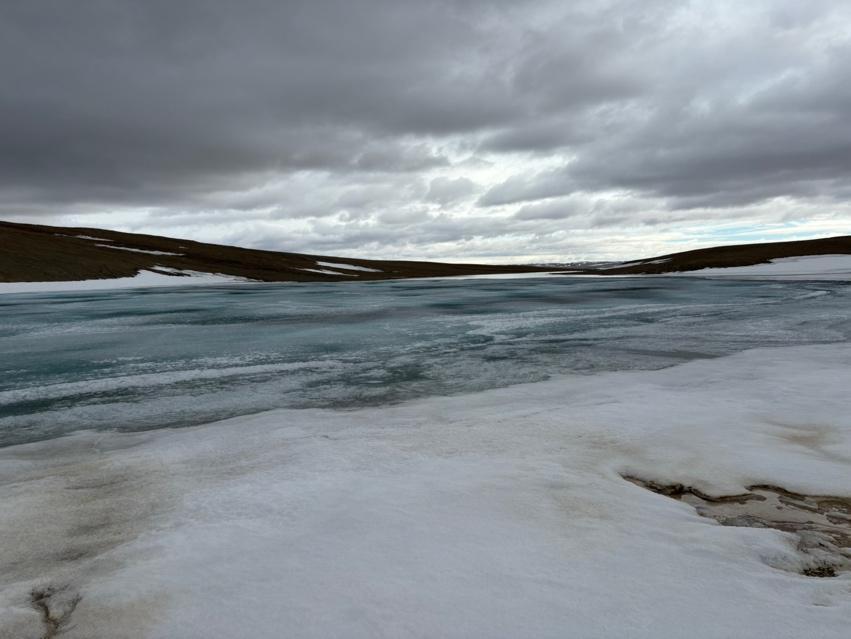
Figure 4. Image of Trinity Lake.
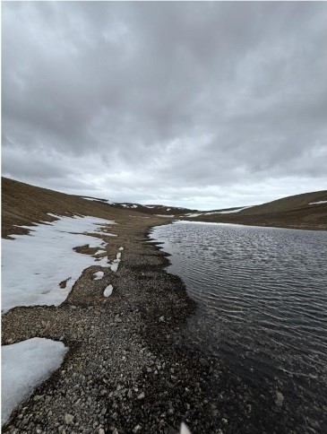
Figure 5. Image of the Trinity Lake area.
All parties rejoined on the low ground after the second lake. The bear-watchers had found an area abundant with purple saxifrage, as well as scat and footprints in the snow. Some of the tracks were small and canine-like suggesting an Arctic fox, and another print raised concerns that it might be a bear track. A similarity with bear tracks was confirmed by online images, but a later discussion with the full crew ruled this out, as there was only a single print. However, it is included in this report as the single print remains a mystery.
The third body of water occupied a larger area than had been there the year before. In this area we found a number of small bryophytes (also known as mosses) and the purple saxifrage flowers common around Resolute. After traversing the west side of the first two lakes, we switched to the east side of the third lake, and the bear watchers once again headed for high ground. We turned the corner of a hill and saw a much flatter alluvial plain ahead of us, beyond which was the site where Terry was hoping to find the algal mats he and Olivia Drayson had found the year before.
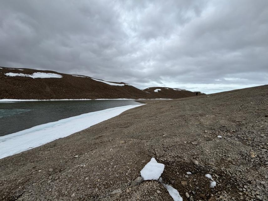
Figure 6. Crewmember traversing the hill near the lake.
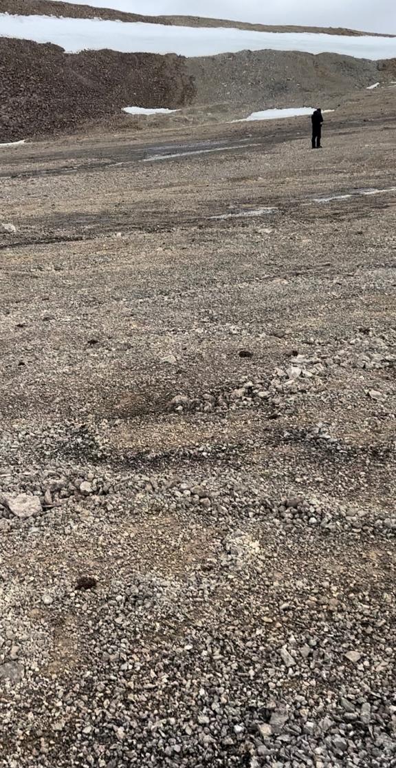
Figure 7. Rock size varies from sand to large gravel.
The alluvial plain was much easier to traverse, consisting mostly of firmer ground and a greater abundance of small rocks. However, there were small creeks running through the plain, fed by the snowmelt on the eastern rise, with softer ground in these areas. Again, the rockier areas were firmer to walk on.
After some searching at the far northern edge of the plain, we found the 12ft x 10in streak of algal mats, which the scientists sampled using techniques documented in the science report. When sampling concluded, we were two hours into the expedition, and the decision was made to return to the station.
Instead of returning the way we had come, we continued up the eastern hill to seek a firmer route home. Once again, the slope itself was soft, so we tried to stick close to the snowline and follow rockier ground. The eastern ridgeline provided some beautiful views across the lakes, and we photo-documented interesting plants and minerals along the way. We found another area with abundant purple saxifrage, and evidence of poppies, though they were not yet flowering.
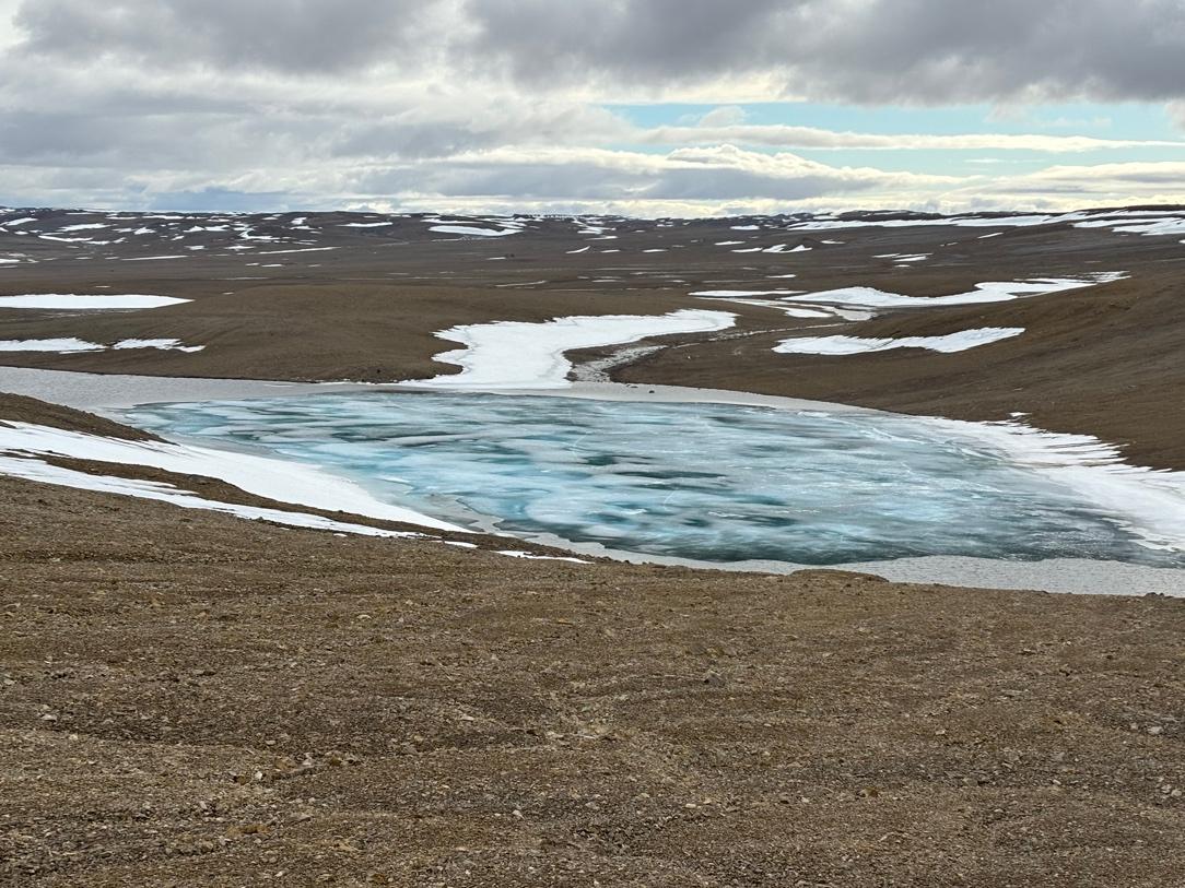
Figure 8. Beautiful views across Trinity Lake.
At the north end of the first lake, we crossed over to the western ridge, trying to stick to the slightly harder ground around the snowbanks and traverse the snow when necessary by using tricks gleaned from experience skiing: feet at a right angles to the slope, weight on the downhill foot, knees slightly bent, etc.
From the western ridgeline, the journey back was a little easier, as we had mostly learned tricks to avoiding sinking into the soil. However, it’s worth noting that at this point – three hours in – it becomes easy for team members to get tired and become complacent at choosing their steps carefully. My recommendation is that expedition members should be forewarned that the ground might be in this soft condition, but that stepping carefully and trying to avoid leaving deep footprints is a crucial part of the expedition, in sim or out, due to the longevity of the prints in this otherwise pristine environment.
We reached the station again at 18:45, three hours and fifteen minutes after we left, having travelled 5.7km. Overall, the science objectives were met, nobody was injured, and all of us present learned about the terrain and some of its pitfalls. We were all blown away by the beauty of the landscape, and the hardiness of the life that survives and thrives in a such a challenging environment.
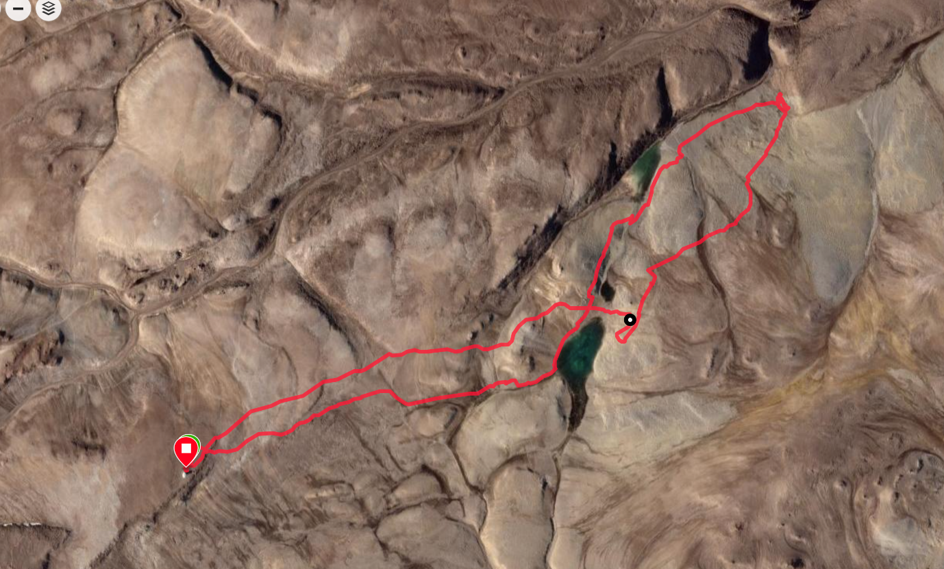
Figure 9. Expedition route.