Flashline-16 EVA Report-02 08-07-2024
Extra-Vehicular Activity Report 02
Leader: Mason Robbins
Team: Michael Andrews
Destination(s): Multiple level locations south and west of the habitat
Transport: On foot
Duration: 1.25 hrs
Time: 1945-2100
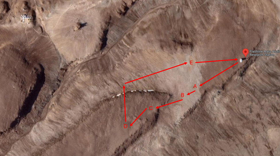
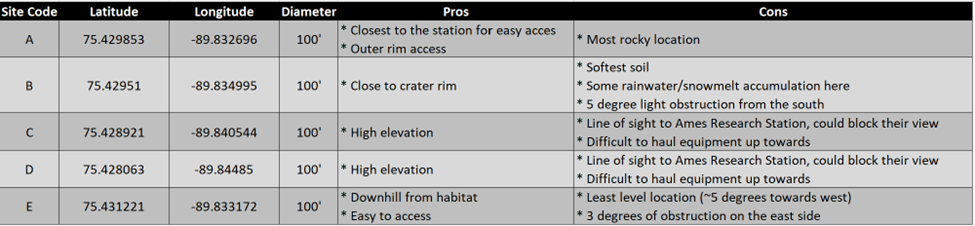
Furthest coordinates from the station: 75.428063 N, -89.84485 W
Expedition Objectives:
- Scout the area surrounding the habitat for (at least) 3 locations for a future Mars Society radio telescope
Equipment Used:
- Bubble level
- Tape measurer
- Wrist slate
- Mobile phone (to log GPS coordinates)
- Walkie-talkie
Expedition Description:
Robbins and I exited the station around 1945 with HSO Swarmer on bear watch. We headed immediately west to find suitable locations for a future radio telescope.
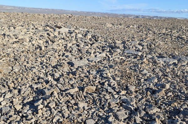
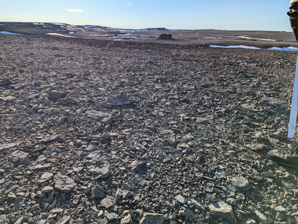
Robbins immediately headed south, and we were instantly met with collection of large dark brown rocks that required careful foot placement to not stumble upon. This continued for several hundred feet – not an ideal area for anchoring any structure.
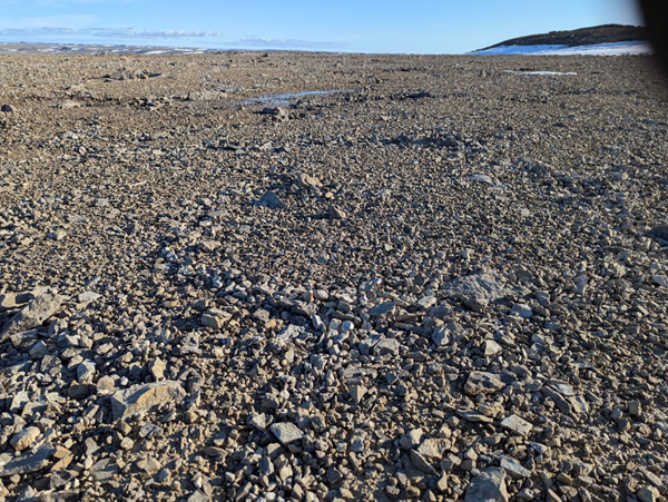
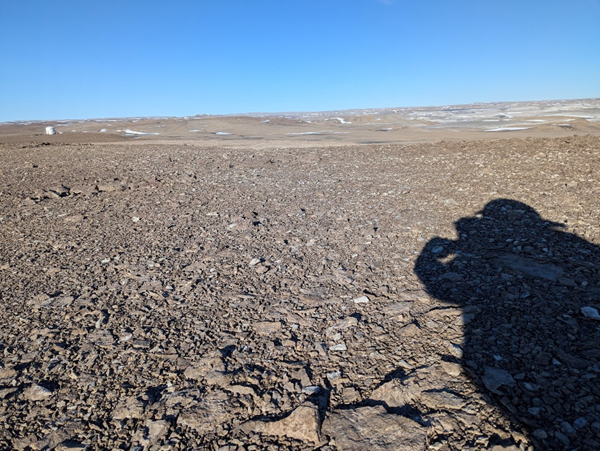
The terrain instantly changed along a boundary that can be seen in the aerial photo below as we approached our first site. The average rock size shrank to no more than an inch, and the terrain changed to more of a beige.
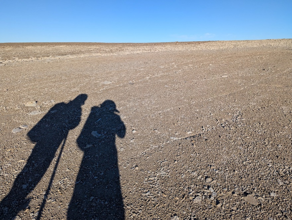
Robbins found his first ideal location, and determined that each site should be a 100’ diameter circle. After doing some preliminary research with Chief Science Officer Nicholson prior to the mission, we learned of the various sizes of radio telescopes. Robbins determined that a 100’ diameter circle would be sufficient for the telescope and any stabilizing anchors connected to the structure via cable, similar to how our research station is secured. To determine this 100’ circle, he used me as a reference and took 4 measurements 50’ from my location. This gave us a good idea of the relative footprint we needed in future sites, and we proceeded further along the ridge. This first site would be known as Site Alpha. It had some rocky terrain that would be hard to develop a foundation for a telescope, but it was close to the hab and suffered minor obstructions.
Further along the ridge, the terrain was still similar and Robbins identified what would become Site Bravo. It contained softer soil that had accumulated some rain and snowmelt from the last few days, but provided similar proximity to the habitat and ridge. Another key difference with Bravo is that it had more obstructions than Alpha. The hill to the southwest of it provided about 5⁰ obstruction from the southwest.
The climb up the hill was quite strenuous; there were no clear paths up without scrambling up rock piles. On top of this hill was a darker terrain, but with similarly small rocks as site Alpha. It provided the best views and least obstructions of any site found yet. However, we did realize that this location obstructs NASA Ames’s research station view to the crater. This is an important consideration, as we want to be good neighbours to our fellow science base occupants. This location was marked as Site Charlie.
Robbins travelled further along the hill, making sure to hug the crater ridge. We passed some rock cairns that had been formed by previous visitors and identified Site Delta. This location provided all of the same pros and cons of Site Charlie, except that it was slightly farther from the habitat.
Robbins then headed away from the crater rim towards Ames. The terrain quickly dropped off to a temporary stream that had formed from recent snowmelt. That being said, there was still a steep snowbank that was 15’ below our current position. Its slope and snowy condition would have been fun to slide down!
We descended down the snowbank and began to return directly to base. On the way, the terrain sloped towards the temporary stream, but there was one area that had ideal ground with small rock size and a homogenous appearance. We marked this as our final site: Site Echo.
The terrain eventually returned to the non-ideal large brown rock terrain that we encountered at the beginning of our EVA, and we returned to the airlock to conclude the expedition. A table summarizing our data can be found below with more objective data, and the photos taken of each site provides more subjective data of site quality.