FLASHLINE-16 Science Report-06 09-07-2024
Author: Natasha Nicholson – Chief Science Officer
Flashline Mars Research Station, Devon Island, 75°25’53”N, 89°49’27”W, Nunavut.
Expedition Commander: Natasha Nicholson
Team: Ilaria Cinelli, Mason Robbins
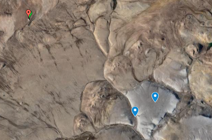
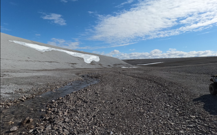
Destination(s): The ‘pale grey mound’ to the southeast of the research station
Transport: ATV
Distance Travelled: 3.94miles/6.34km
Furthest coordinates from the station: 75°24’12.9”N, 89°48’41”W
Expedition Duration: 4.35hrs
Time: 11.45 – 16.20
Aims:
- To measure the depth of the permafrost
- To collect some pale-grey carbonate rich breccia and surrounding material
Permafrost measurements:
We followed previous ATV track southeast to a large pale grey mound, similar to the one we had found on our expedition into the crater. We planned to sample from the edge of the mound, where the soil transitioned suddenly into the characteristic homogenous pale grey, however, finding large CAT tracks already leading up the mound (possibly from the HMP facility vehicle), our navigator in the lead ATV continued on to the top.
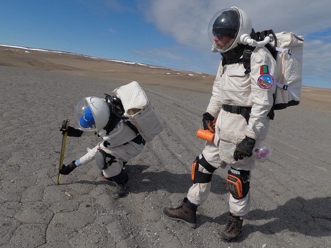
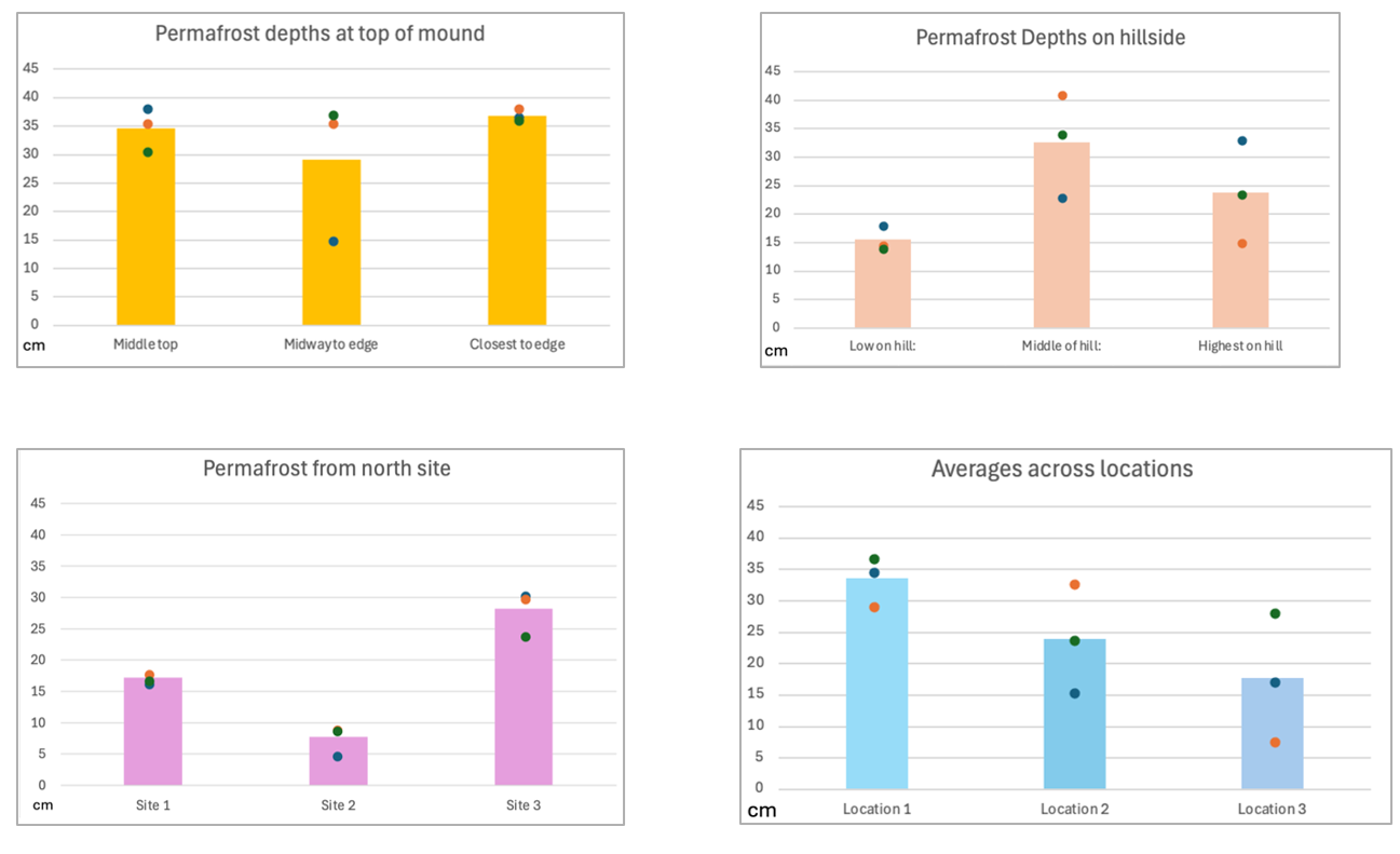
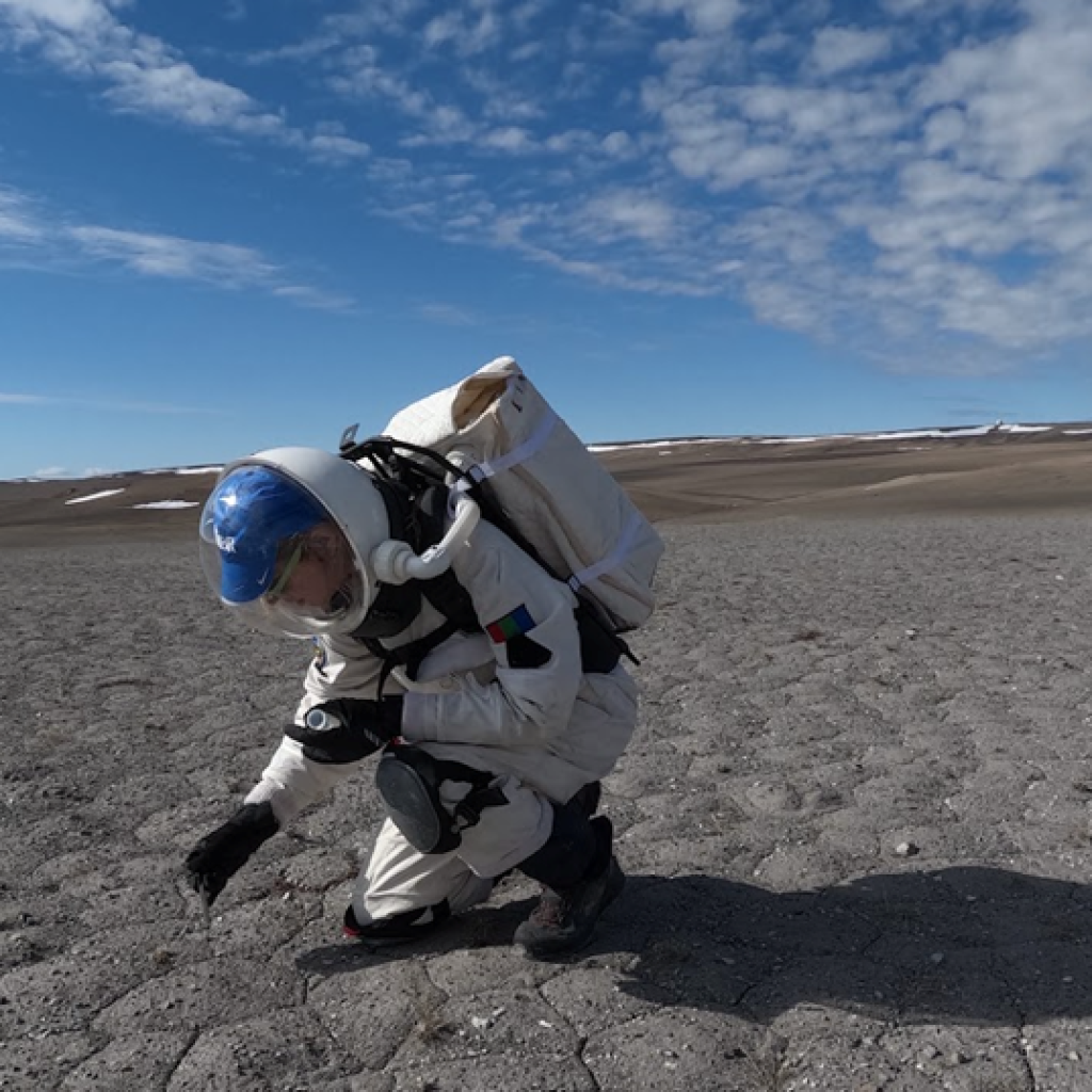
We took 3 sets of 3 permafrost measurements from what we estimated to be the middle top of the mound, (75°25’16.6”N, 89°45’47.3”W), then followed the trail back to where it had diverged from the original track by the river. We followed the river around to the base of the mound, and took another 9 (3 sets of 3) from a lower hillside across the stream from the mound (75°25’08.4”N, 89°46’15.2”W). Our permafrost depth measurement methodology was similar to that from a paper by Boike et al. (2021) ‘Standardized Monitoring of Permafrost Thaw: A User-friendly, Multiparameter Protocol’. It involved sinking a metal rod into the ground until it met with resistance of the frost table, giving it some light taps with a rubber mallet, and then measuring the amount of the rod still protruding the ground. This was repeated three times along a transect, each time in triplicate. Subtracting this from the total length of the rod gave us the depths reported below.
The averages, with the range of the individual samples plotted against them, can be seen in Figs 1, 2 and 3. Outliers are likely due to rocks in the sample column.
A second EVA team went farther north to coordinates and took further permafrost measurements from 75°26’27.6”N, 89°51’44.7”W. They speculated they may have hit a shelf of rock at site 2, but the data has been included with that caveat. (More about their expedition will be communicated via their EVA report).
Soil Sampling
On the morning EVA, on top of the grey mound and at the adjacent hill, we took one shallow soil sample from each of the sample sites, three in total for the top of the mound, three in total from the adjacent hill. A lab scoop was inserted into the ground, approximately 3 inches in depth, and rotated so the curved edges created a cylindrical sample, which was extracted and inserted into a 50ml falcon tube.
Return to the Hab
Having measured and sampled at both sites, we took a short moment to appreciate the peace and serenity of the small river by the second sampling site.
References
Boike, J., Chadburn, S., Martin, J., Zwieback, S., Althuizen, I.H., Anselm, N., Cai, L., Coulombe, S., Lee, H., Liljedahl, A.K. and Schneebeli, M., 2021. Standardized monitoring of permafrost thaw: a user-friendly, multiparameter protocol. Arctic Science, 8(1), pp.153-182.